West of Needles, Route 66 crosses California's desolate Mojave Desert, following the railroad built through here in the 1800s. In the 1880s the Atlantic & Pacific Railroad created a series of small towns as water stops along its railroad. They’re called the “alphabet towns” because the railroad named them alphabetically from west to east: Amboy, Bristol, Cadiz, Danby, Essex, Fenner, Goffs, Homer, and Ibis. All the alphabet towns were eventually bypassed by newer alignments of Route 66 or by I-40. Today some are tiny towns, some are ghost towns, and some have vanished completely.
From Needles, we took I-40 about 7 miles to Exit 133 (US 95). Here two “alignments” of Route 66 split. The original 1926 alignment follows CA 66, which arcs to the northwest through the town of Goffs, then southwest to I-40. The 1931 alignment is gone, replaced by I-40. We followed the original 1926 alignment by heading north on US 95. In about 5 miles, we turned left (west) on CA 66. This intersection was once the alphabet town of Ibis.
We continued west on CA 66, running along the south side of the railroad. The alphabet town of Homer was once here, but all signs of it are gone.
 |
| Route 66 (CA 66) west of Goffs |
In about 13 miles we reached the tiny town of Goffs. Just before Route 66 crosses the railroad tracks, we saw an abandoned general store on the north side of the road.
 |
| Former general store in Goffs |
Right after crossing the railroad tracks, Route 66 turns left to continue west along the north side of the railroad tracks. In about 500 feet, we turned right (north) onto Lanfair Road. In a few hundred feet we reached Goffs Schoolhouse, built in 1914 and nicely restored.
 |
| 1914 Goffs Schoolhouse |
A sign near the schoolhouse explains that, during World War II, Goffs was the center of a desert army training camp, with as many as 10,000 troops stationed here.
 |
| Sign at Goffs Schoolhouse |
The school is fenced and was closed when we visited. After we saw the sign below, we decided not to wander around!
 |
| Warning sign near Goffs Schoolhouse |
 |
| Replica of Goffs Depot |
Goffs is called the Desert Tortoise Capital of the Road, but we didn’t see any. We visited in late October, and the tortoises hibernate underground from November through February.
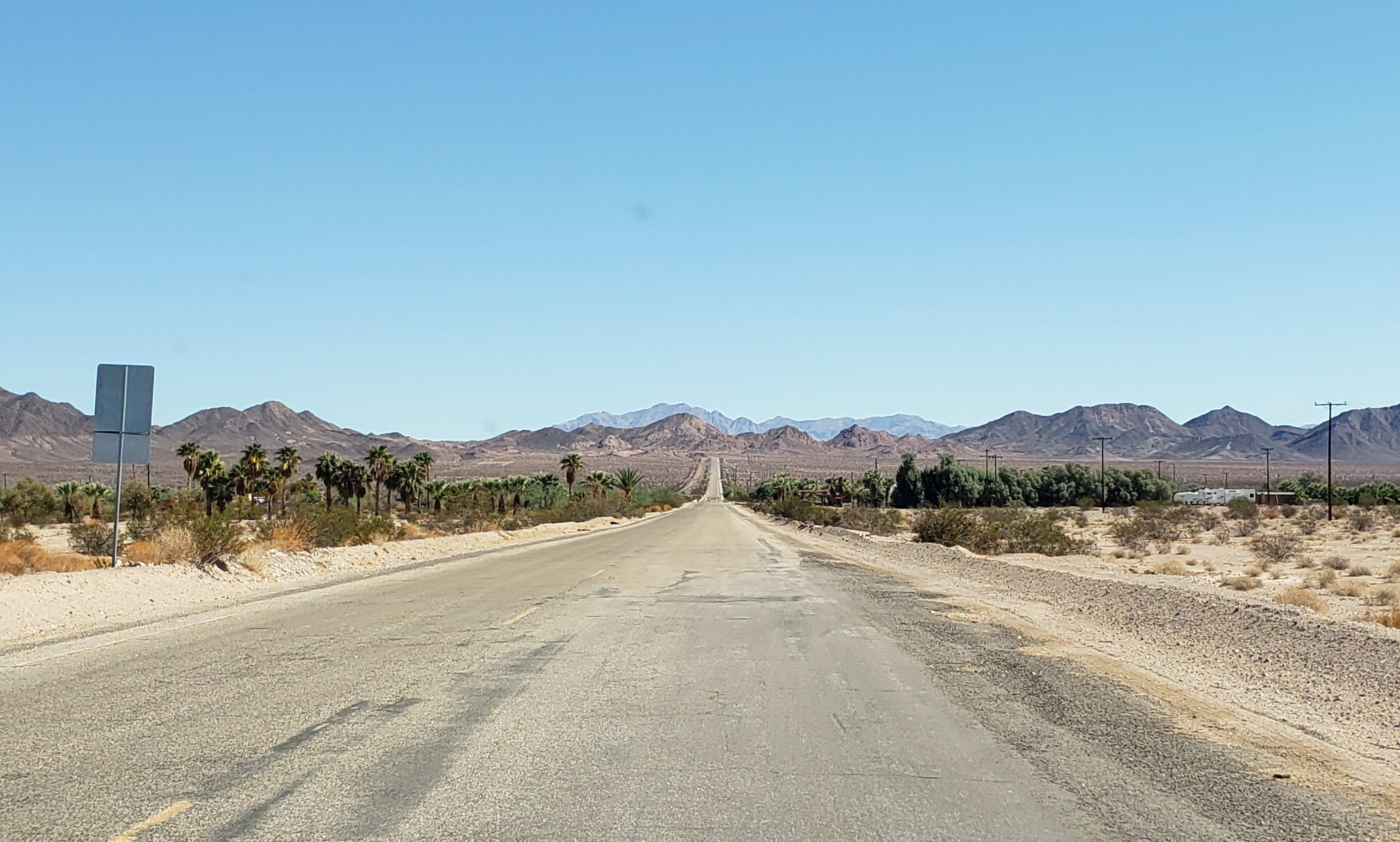
West of Goffs, Route 66 continues along the north side of the railroad tracks.
 |
| Route 66 west of Goffs |
Just before I-40, we saw the Desert Oasis gas station on the left. This is about all that's left of the alphabet town of Fenner. If you need gas, get it here—there’s no more gas for at least the next 55 miles.
 |
| Desert Oasis gas station in Fenner |
About 3 miles south of I-40, Route 66 is closed because floods have washed out some of the bridges.
 |
| Route 66 closure at Fenner |
So we took I-40 west about 30 miles to Kelbaker Road, then took Kelbaker Road about 11 miles south to rejoin CA 66. While we missed seeing what’s left of Essex and the Cadiz Summit, we were glad we drove Kelbaker Road, because the views are stunning.
 |
| Looking south on Kelbaker Road |
When we reached CA 66 (also called the National Trails Highway), we turned left (east). There’s a sign that the road is closed, but you can drive it about 5 miles or so before it really closes.
 |
| Route 66 road closure east of Kelbaker Road |
Once again the views were stunning. Far ahead, Route 66 bends to the left (northeast) and passes through Cadiz Summit.
 |
| Route 66 west of Chambless, looking west |
Along the road is “rock graffiti”: hundreds of travelers have spelled out their names with rocks.
 |
| "Rock graffiti" along Route 66 west of Chambless |
In about 4 miles, we reached the remains of the Road Runners Retreat.
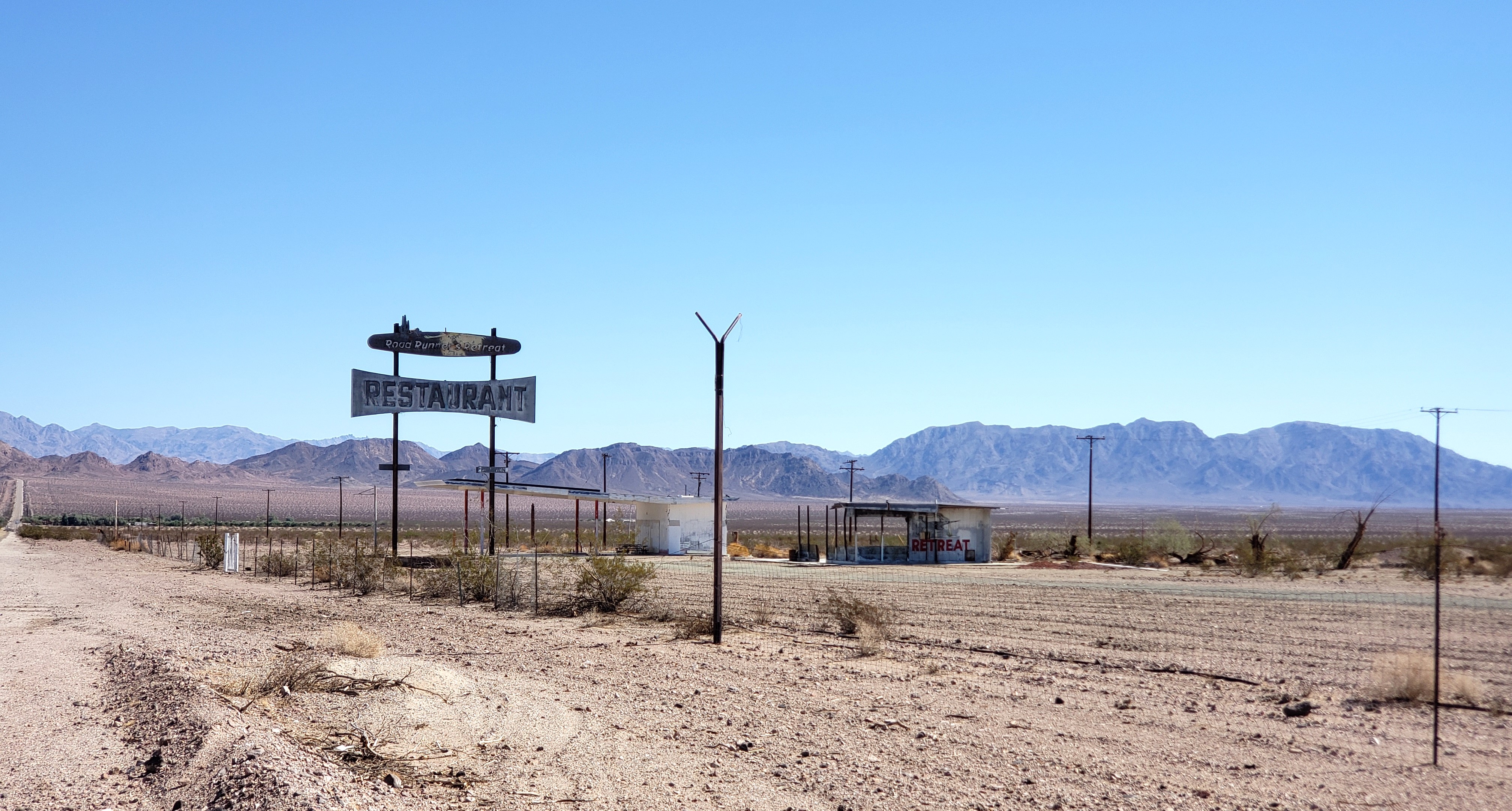 |
| Road Runners Retreat near Chambless |
Road Runners Retreat was once a truck stop. The gas station is on the left and the restaurant on the right.
In another mile and a half, we reached the town of Chambless.
 |
| Chambless, California |
You may recall that the “alphabet towns” included Cadiz, not Chambless. Between Essex and Amboy, the railroad and the original National Trails Highway runs a few miles south of Route 66. Cadiz was established along the railroad about 3 miles south of where Chambless is today. Route 66 was built north of the railroad and the original National Trails Highway, bypassing Cadiz. Chambless was established in the 1930s and named for the family who settled there.
What’s left of the Wayside Café is on the southwest corner of CA 66 and Cadiz Road.
 |
| Wayside Cafe in Chambless |
There’s also a monument to Route 66 here with a plaque.
 |
| Route 66 plaque in Chambless |
CA 66 is truly closed to all traffic past Cadiz Road, so we turned around and headed back west. We could see Amboy Crater, a volcanic cylinder cone, in the distance.
 |
| Route 66 looking west toward the (low black) Amboy Crater |
About 4 miles west of Kelbaker Road we reached an iconic Route 66 stop: what’s left of the town of Amboy. Amboy was a true oasis for Route 66 travelers until I-40 opened. After I-40 opened, many of the structures were bulldozed to avoid paying property taxes on them. But there's still a post office here on the south side of the road.
 |
| Amboy Post Office with Amboy Crater on the right |
The remains of Amboy School are here, too, on the north side of the road.
 |
| Amboy School |
But what makes Amboy iconic is Roy’s, a complex built to serve Route 66 travelers.
 |
| Roy's in Amboy |
Today Roy’s is an icon of a lonely desert gas stop and has appeared in films, ads and commercials, video games, and more. (Wikipedia has a pretty extensive list.)
Roy Crowl opened Roy’s gas and service station in 1938. In 1945 he and his son-in-law added a café, which is now a gift shop.
 |
| Former cafe at Roy's, now a gift shop |
 |
| Interior of the former cafe at Roy's, now a gift shop |
In 1948 Roy and his son-in-law added cabins.
 |
| Cabins at Roy's |
A true motel was built behind the cabins and, in 1959, Roy and his son-in-law added Roy’s iconic sign and motel office in space-age “Googie” style.
 |
| Roy's motel office, cabins and sign |
While all the buildings have been spruced up on the outside, only the gift shop in the former café is open.
West of Amboy, Route 66 was again closed because of bridge washouts when we visited in October 2022. So, after this great stop, we drove back east toward Kelbaker Road, enjoying the magnificent views one last time.
 |
| Route 66 east of Amboy, looking east |
We then drove back north on Kelbaker Road to I-40 and our next Route 66 stop: Ludlow, California.


Thanks for the explanation of "Alphabet Towns", not explained in the Wikipedia entry on Chambless, California.
ReplyDeleteYou're welcome! The Chambless entry in Wikipedia clearly needs more info!
Delete