Showing posts with label Illinois. Show all posts

Saturday, February 19, 2022

Litchfield, Mt. Olive, and Collinsville, Illinois

As I note in my post on Auburn through Carlinsville,Illinois, Route 66 has two “alignments” south of Springfield, Illinois, that are as much as ten miles apart. When we have a choice of Route 66 alignments, we try to choose the one that looks more interesting--often the older alignment. Here we thought the northern part of the 1926 alignment and the southern part of the 1930s alignment looked interesting, so we decided to experience both. We first drove the 1926 alignment from Springfield to Carlinsville--I shared that leg in my last post. From Carlinsville, we used our GPS to cut over backroads to join the 1930s alignment at Litchfield, which is where this post begins.

Litchfield has two Route 66s, labeled on Google Maps as “Historic Route 66” and “Old Route 66.” They merge at North 13th Avenue. Old Route 66 has more to see, so we took it into town. We immediately passed the 1951 Skyview Drive-In movie theater with a great neon sign.

Skyview Drive-In sign in Litchfield, Illinois (from CinemaTreasures.org)

Two blocks south, just past Union Avenue, is a Route 66 gem: the 1935 Ariston Café.

Ariston Cafe in Litchfield, Illinois

It’s on the National Register of Historic Places. Unfortunately we were too full from an earlier lunch to stop here, but I’ve read that the food is great.

About a half a dozen blocks south of the Ariston Café, at 825 Old Route 66, is another Route 66 treasure: the 1936 Belvidere Café, Motel & Service Station, closed since the 1970s, when I-55 opened.

Former Belvidere Cafe, Motel & Service Station in Litchfield, Illinois (from the-route66.com)

This is another Litchfield property on the National Register of Historic Places. One of the reasons it's special is because so much of the entire complex--restaurant, motel, and service station--is still intact, though in deteriorated condition.

About a mile south of the Belvidere, Old Route 66 merges back into Historic Route 66. We followed it about eight miles into Mt. Olive, Illinois. The southbound side of this stretch of Route 66 was built during World War II. The northbound lanes were built in the 1950s.

Just before Mt. Olive, Route 66 splits, with the World War II alignment bending to the right and a 1930-1940 alignment turning left. The 1930-1940 Old Route 66 then bends right (west), then left (south) through Mt. Olive. Two blocks south of West Main Street, at 710 West 1st South Street, is yet another Route 66 gem, the beautifully restored 1926 Soulsby Service Station.

Soulsby Service Station in Mt. Olive, Illinois

It’s also on the National Register of Historic Places. Unfortunately it was closed when we visited, but we got a kick out of the old car lift with a tree growing through it!

Car lift at the Soulsby Station in Mt. Olive, Illinois

From the Soulsby Station, we stayed on Old Route 66 until it merged into the newer alignment about two miles south of town. About a half mile later, bear right (southwest) to go back onto the 1930-1940 Route 66 alignment.

Old Route 66 bends around the perimeter of Staunton, Illinois, and passes Henry's Rabbit Ranch, with a replica of an old gas station and a collection of kitsch.

Henry's Rabbit Ranch in Staunton, Illinois (from TrailerLife.com)

Between the Rabbit Ranch and St. Louis, Missouri, Route 66 gets really complicated. I’ve mentioned throughout this blog that Route 66 has had multiple “alignments” over the years. The St. Louis, Missouri, area is a great example of this. Before 1930, Route 66 crossed the Mississippi on McKinley Bridge, a couple of miles north of the Gateway Arch. From 1936 to 1968, there were two Route 66s through this area. “Bypass Route 66” crossed the Mississippi on the Chain of Rocks Bridge, just south of I-270 and about ten miles north of Saint Louis. “City Route 66” crossed the Mississippi on Eads Bridge, just north of the Gateway Bridge. And so far I’ve just described the Route 66 bridges crossing the Mississippi, not the Route 66 roads leading to the bridges, which resemble a pile of spaghetti.

To be honest, there’s not a lot of vintage Route 66 to be seen on any of these approaches. Vintage Americana is more likely to survive in rural areas than in urban areas. Just two stops appealed to us: the 1929 Chain of Rocks Bridge near Madison, Illinois, and the 1949 World’s Largest Catsup Bottle in Collinsville, Illinois. Unfortunately, they’re pretty far apart, so we opted for just one: the World’s Largest Catsup Bottle  at 800 South Morrison Avenue in Collinsville. We used our GPS to get there rather than try to stick to one of the Route 66 alignments.

World's Largest Catsup Bottle in Collinsville, Illinois

The catsup bottle is a water tower built for a now-defunct catsup bottling plant. As you can see, it’s been beautifully restored. There’s no parking along South Morrison Avenue, but we found a parking lot about a block south and walked up to take pictures.

From here we again used our GPS to get to our hotel in Saint Louis, because East Saint Louis can be dangerous—it’s not an area we wanted to spend a lot of time in.

While we enjoyed the World's Largest Catsup Bottle, we were sorry to miss the Chain of Rocks Bridge.

Chain of Rocks Bridge near Madison, Illinois (from Route66news.com)

The National Park Service calls it one of the more interesting bridges in America. It was an unusually massive construction project for the 1920s, and it has an interesting quirk: it bends at a 30 degree angle in the middle of the river. (Click the National Park Service link to find out why.) The bridge closed in 1969 and reopened as a biking/hiking trail in 1999.

One of the reasons we decided not to visit the Chain of Rocks Bridge is that every resource I consulted warned that cars parked at either end of the bridge see frequent break-ins, and everything in your vehicle should be stored out of sight in your trunk. We were driving an SUV, so this wasn’t an option. (The bridge has received a grant from the National Park Service for a variety of improvements, including security.) If we had gone, we would have driven to the Chouteau Island Fishing Area just south of the bridge, which offers a great view of the bridge from the shoreline without leaving our car.

Thursday, February 10, 2022

Auburn, Girard, Nilwood, and Carlinsville, Illinois

As I note in my page on setting priorities for a Route 66 road trip, there are multiple Route 66s to explore. As traffic grew, new stretches of Route 66 were built to straighten out curves, level out hills, better handle increased traffic, and bypass towns overwhelmed by traffic.

Usually new “alignments” were built near previous alignments, but south of Springfield there are two alignments that are as much as 10 miles apart. The 1926-1930 alignment mostly follows what’s now IL 4, while the 1930s alignment is closer to I-55.

There are great things to see on both alignments, but we didn’t want to backtrack and drive both of them. We split the difference. We drove the 1926 alignment from Springfield to Carlinsville, then cut over to join the 1930s alignment at Litchfield.

About 10 miles south of Springfield is a Route 66 treat: a 1.4 mile stretch of road paved in brick.

Brick highway north of Auburn, Illinois

To find it, about 3 miles before Auburn, Illinois, turn right on Snell Road (on the left side of IL 4 it’s Hambuch Road). The brick road curves left to join IL 18 (Curran Road), which rejoins IL 4.

The National Park Service says this stretch was first paved in concrete around 1921. It was widened and paved with brick in 1932…two years after Route 66 was moved east. I’ve read several possible reasons why this segment was paved in brick. I think the most plausible story is that a local brick manufacturer did this segment to demonstrate the feasibility of brick road paving.

About 10 miles south of Auburn, we had a terrific lunch at the 1957 Whirl-a-Whip in Girard, Illinois.

Whirl-a-Whip in Girard, Illinois

Check that cool old sign! This is a counter service restaurant, with outdoor seating, open seasonally. We ordered two regional specialties. My husband had a huge pork tenderloin sandwich.

Pork tenderloin sandwich at Whirl-a-Whip in Girard, Illinois

I got a horseshoe, which is a piece of bread topped with meat, fries, and a creamy cheese sauce.

Horseshoe at Whirl-a-Whip in Girard, Illinois

I chose pork tenderloin as my meat. To be honest, I didn’t order a horseshoe—this is a ponyshoe, a smaller version of a horseshoe. It was still huge.

Even with these huge lunches, we managed to share some ice cream for dessert (as my husband says, it seeps down between the cracks) before heading off again.

Just past the Whirl-a-Whip, turn right (west) on West Franklin, then left (south) on South 6th Street. This becomes Cambridge Road, then 1950E Road. This stretch of Route 66 was built in 1919, so it’s older than Route 66. (And, yes, this is the stretch of Route 66 shown on the home page of this blog.)

1919 stretch of Route 66 between Girard and Nilwood

It was very cool to drive on a road over 100 years old! This photo with our vehicle shows how narrow the road is.

Another shot of the 1919 stretch of Route 66 between Girard and Nilwood, Illinois

To continue on this original stretch of Route 66: when 1950E road ends at 2800 N Road, turn right (west) on 2800 N Road. In about a half mile, it turns left (south) and becomes North Standard City Rad. In other half mile, turn right (west) on 2750 N Road. When you reach the town of Nilwood, 2750 N Road turns left (south) and becomes Pine Street. In a few hundred feet, turn right (west) on Morean Street, which returns you to IL 4.

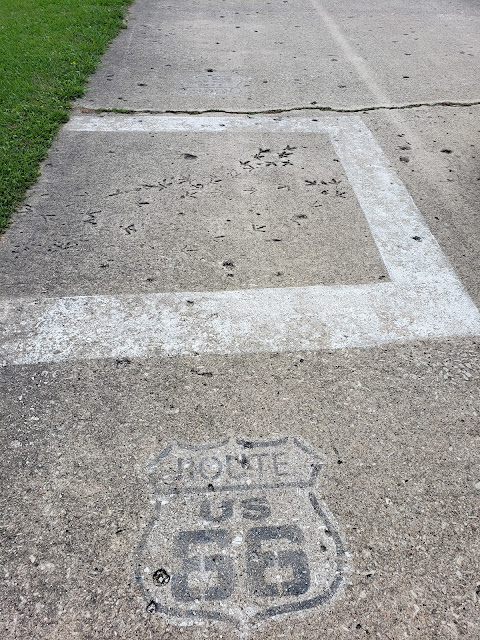
About a mile past Nilwood is another old stretch of Route 66, this one from the 1920s. Turn left (east) on Carlinville Cutoff Road, then take an immediate right (south) on Donaldson Road. This old stretch has an extra treat. In about a quarter mile, there are turkey tracks in the concrete.

100-year-old turkey tracks south of Nilwood, Illinois

You won’t miss them—someone has thoughtfully put up a sign and marked the tracks with road paint and (now fading) Route 66 shields..

Turkey tracks sign
 
Continue on Donaldson Road until it ends at Allen Road. Turn right (west) on Allen Road to get back to IL 4.

About 8 miles south of the turkey tracks is the town of Carlinville, Illinois.

According to Jim Hinckley in his book Travel Route 66, in 1918 Standard Oil expanded its mining operations here and faced a housing shortage for its workers. The company solved the problem by buying and building 150 Sears mail-order homes in a section of Carlinville known as the Standard Addition. We thought this would be interesting to see, so we detoured off IL 4 and drove down Johnson Street, which was in the middle of the 12-block Standard addition. We thought it would look like an early version of Levittown (modest houses all originally the same model, but now altered over the years), but it ended up not being very interesting. There are a lot of older houses, but they’re all very different styles. We weren’t even sure which houses would have been Sears mail-order houses.

We rejoined IL 4 and drove through Carlinville’s historic district, which is on the National Register of Historic Places. The center of town is a square featuring an adorable “rotunda.”

Carlinville rotunda (from EnjoyIllinois.com)

The square is surrounded by charming Victorian buildings.

Downtown Carlinville (from Carlinville.com)

Just past the square (which is really an oval), Route 66 turns left (east) on East 1st South Street. In just a block on the left is the Macoupin County Courthouse.

Macoupin County Courthouse in Carlinville, Illinois (from MyJournalCourier.com)

It was built in 1870 at a cost of over $1 million—an extravagant sum that immediately led to an investigation into construction graft. This article tells more of the story. 

Across the street from the Courthouse is the Macoupin County Jail, built in 1869. .

Macoupin County Jail in Carlinville, Illinois (from MacoupinCountyIL.gov)

 This description of the jail explains how surplus Civil War cannonballs were used in its construction to prevent jailbreaks.

After Carlinville, we left the 1926 alignment of Route 66 and drove east to Litchfield, Illinois, to continue our trip on the 1930s alignment.


Sunday, January 30, 2022

Springfield, Illinois

We really enjoyed our stop in Springfield, Illinois. There’s so much to see that you could easily spend a day here, but we spent just a few hours in the morning. We decided our priority would be the Abraham Lincoln Presidential Library and Museum. That turned out to be a good decision--it’s one of the best museums we’ve ever seen.

Springfield, Illinois, is big enough that you have to hunt for parking downtown. Because we arrived early in the morning, we found free parking near the Lincoln Home Visitor Center, on South 7th Street between East Capitol Avenue and East Edwards Street.

Lincoln Home Visitor Center (from recreation.gov)

We stopped first at the Visitor Center to pick up information on local sights, then we walked about five blocks north to the Abraham Lincoln Presidential Library and Museum. The entrance is at the corner of North 6th Street and East Jefferson Street.

Abraham Lincoln Presidential Library & Museum

Inside, a very friendly guide ushered us into a huge atrium and pointed out where we could start our self-guided tour. My husband took this 360-degre panoramic shot of the atrium. The floor tile is actually laid out like a star, but in this shot it's a cool optical illusion!

360-degree view of the Lincoln Presidential Museum atrium

The entrance into the atrium is in the center of this photo. On the far right is a recreation of the Lincoln’s cabin. From there the tour goes through recreations of several scenes in Lincoln’s life plus rooms with all kinds of interesting artifacts. The tour exits next to the model White House on the left. Those are mannequins of Lincoln and his family on the left; visitors posed with them for selfies.

Each stop on the tour was fascinating. I was surprised how much we learned about Lincoln. I had no idea how controversial the Emacipation Proclamation was.

The atrium also featured a live musician playing period music.

Musician in the atrium of the Abraham Lincoln Presidential Museum

Then, an unexpected treat: We toured the “State of Sound” special exhibit on Illinois musicians. We could see videos and artifacts of Illinois musicians from practically every possible music genre. My husband especially enjoyed the Chicago blues exhibit, and my favorite was a video clip of Steve Goodman in the folk music exhibit.

We then walked back to the Lincoln Home, on South 8th Street, between East Capitol Avenue and East Jackson Street.

Lincoln Home in Springfield IL

The buildings around the Lincoln Home has been preserved to look like they did in Lincoln’s time, so the street is like stepping back in time.

If you’re interested in Lincoln, there’s a lot more to see in Springfield, most within walking distance: a recreation of his law offices, the train depot where he left for Washington, the church he worshipped at, and the State Capitol where he served. Lincoln’s tomb is a mile or two north.

Springfield also has three iconic Route 66 restaurants, all serving Springfield specialities. The 1926 Maid-Rite Sandwich Shop is at 118 North Pasfield Street.

Maid-Rite Sandwich Shop in Springfield, Illinois (from SangamonCountyHistory.org)

Maid Rite is known for “loose” hamburger sandwiches—not formed into patties.

Just a few blocks south of the Lincoln Home is the Chili Parlor at 820 South 9th Street. (Some resources call it Joe Roger’s Chili Parlor.)

The Chili Parlor serves Springfield chilli—yes, they spell it with two Ls.

 At the southern end of Springfield is the Cozy Dog Drive In, which invented corn dogs.

Cozy Dog Drive In in Springfield, Illinois (from route66guide.com)

Unfortunately, we finished our visit to Springfield in the morning, too early to stop at any of these places for lunch. If we had stayed for lunch, I don't know which place we would gave gone to--they're all really special!

On our way out of Springfield, we saw one more Route 66 treat: the Lauterbach Giant at 1569 Wabash Avenue. (Some resources say it is in Jerome rather than Springfield.)

Lauterbach Giant on Wabash Avenue in Springfield, Illinois

This is one of the “muffler men” we first saw in Wilmington, Illinois.

South of Springfield, Illinois, we faced a choice of Route 66 routes, which I’ll share in my next blog post.

Tuesday, January 18, 2022

Atlanta, Lincoln, and Sherman, Illinois

South of Bloomington, Illinois, Route 66 runs alone the northwest side of I-55. Our first stop south of Bloomington was Atlanta, Illinois. As we approached Atlanta, we turned right (west) on Sycamore Street. Here we saw a welcoming billboard.

Atlanta IL billboard (from route66news.net)

Sycamore merges into North East Arch Street, which goes into the center of Atlanta. 

Like Pontiac, this is a good place to get out of the car and walk. There are several interesting sights within a few blocks of each other.

The most eye-catching sight is a “Muffler Man” statue, this one of Paul Bunyon (yes, it's spelled that way) holding a giant hot dog. 

My post on Wilmington, Illinois, tells the story of the Muffler Men. This statue was once in front of Bunyon’s, a hot dog stand in Cicero, Illinois, near Chicago. The restaurant was purposely spelled Bunyon, not Bunyan, to avoid any copyright  issues. In 2002, the restaurant closed, the statue was put up for sale, and Atlanta acquired it. A sign near the statue tells more of its story.

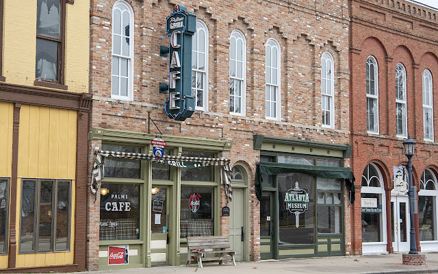
Across the street from the Paul Bunyon statue is a historic gem: the 1967 Downey Building

Downey Building in Atlanta IL (from DestinationLoganCountyIL.com)

The Downey Building was built in the Italianate style popular in the mid-1800s. The arched windows are one characteristic of Italianate style. The Downey Building is in the National Register of Historic Places.

In 1934 the Palms Grill opened in one side of the Downey Building. Over the years, the interior was altered but today it’s been restored to how it looked in 1934.

Interior of the Palms Grill in Atlanta IL

Look closely at the photo of the Downey Building, and you can see that the Palms Grill was once a Greyhound Bus Stop.

Unfortunately, the Palms Grill and the Atlanta Museum were closed when we visited in October—they’re only open May through September. (In fact, virtually all the shops on South West Arch Street were closed.)

Several murals were added around downtown Atlanta in 2002. This is one of my favorites at 114 South West Arch Street, on the building to the right of Paul Bunyon.

Mural at 114 South West Arch Street in Atlanta IL (photo from DestinationLoganCountyIL.com)

Judy & Sons were once grocers on the first floor of this building. This mural is a recreation of a mural that was on the building around 1900.

Half a block to the left of Paul Bunyon, at the corner of South West Arch Street and South East Race Street, is a lovely Seth Thomas clock built in 1901.

Atlanta IL Clock Tower (from elevation.maplogs.com)

It was originally at the high school, then moved here. The clock is still hand wound by volunteers.

Behind the clock is the beautiful 1908 public library.

Atlanta IL Library (from atlantapld.org)

Behind the library on 1st Street is the 1903 J. H. Hawes Grain Elevator. It’s also on the National Register of Historic Places.

J. H. Hawes Grain Elevator in Atlanta IL (from DestinationLoganCountyIL.com)

South West Arch Street merges back into Route 66, which we followed to Lincoln, Illinois. We wanted to take the 1926 alignment through Lincoln, so just before town, we turned left on Kickapoo Street. In a bit over a mile, we turned right onto Keokuk Street, which took us back out to the 1940s Route 66, also known as Lincoln Parkway. About a mile down Route 66, on the right, on the grounds of the Best Western Lincoln Inn, is the World's Largest Covered Wagon. Some resources call it Railsplitter Covered Wagon.

World's Largest Covered Wagon in Lincoln IL (from waymarking.com)

It features a statue Abe Lincoln reading a law book. The statue was built in Wisconsin in 2001 and moved to Lincoln in 2007.

South of Lincoln, about a half mile before the Lincoln Parkway intersects with I-55, “Historic U.S. 66” turns off to the left (south). At this point we were nearing the end of a long day and headed straight into Springfield, Illinois, for the night. But near Sherman, Illinois, just north of Springfield, there are some fragments of Route 66 from the 1920s. One is a 1922 segment in Carpenter Park in Sherman that’s on the National Register of Historic Places . If you’d like to walk it (it’s just a quarter mile long), turn right (west) on Cabin Smoke Trail. The 1922 segment will be on your left.

Route 66 segment in Sherman IL (from LegendsOfAmerica.com)

The segment ends at the river, where the bridge that once crossed the Sangamon River is now gone. 


Saturday, January 8, 2022

Lexington, Towanda, and Normal. Illinois

After exploring Pontiac, Illinois, we passed through three more Illinois towns along Route 66: Lexington, Towanda, and Normal.

About a mile before Lexington, Route 66 veers away from I-55. About a half mile later, we turned left onto Parade Road, also known as Memory Lane. This is an original 1926 stretch of Route 66 that now has reproductions of vintage road signs.

Memory Lane in Lexington, Illinois

I’d read that Memory Lane is often closed to vehicles, but it was open for driving when we visited in October 2021. With I-55 and the newer Route 66 bypass out of sight, we got a real sense of what it was like to travel on the original Route 66. 

After Memory Lane, the original Route 66 becomes West Wall Street and then North Grove Street, rejoining the newer Route 66 bypass south of Lexington. Instead of following the original route all the way through town, we turned right (west) onto Main Street to try to see a restored 1949 neon sign pointing travelers from the bypass to downtown Lexington, but we somehow missed it.

Neon sign pointing to Lexington, Illinois (from TheRoadWanderer.net)

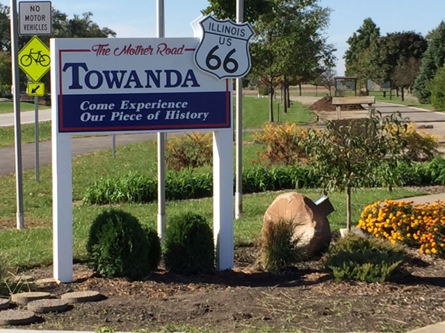
A few miles further down Route 66 from Lexington is Towanda, Illinois. Back around Odell, Illinois, we saw stretches of an abandoned Route 66 roadbed that runs parallel to today’s Route 66. That abandoned roadbed appears again in Towanda. Here it’s been converted into a really nice roadside walking path, shown on Google Maps as Historic Route 66 Trail and sometimes called the Parkway or Route 66 Walking Tour.

Original Route 66 (on right) through Towanda, now a walking trail (from Route66 Towanda.org)

The trail runs about 3 ½ miles. This would be a great place to stretch your legs.

 Also in Towanda is Dead Mans Curve, a spot where the 1926 Route 66 made a sharp 90-degree turn. 

Towanda's Dead Man's Curve (from CuriousTraveler66.wordpress.com)

To reach it, turn right (north) at the intersection of Route 66 with South Jefferson Street on the left and North 1900 East Road on the right. Take the next left on Jackson Street. Jackson Street was once part of the 1926 “alignment” and soon take a sharp left turn onto Quincy Street. This is Dead Mans Curve. There are plenty of signs, including some Burma Shave signs, so you can’t miss it.

Illinois is mostly flat, so many of original roads ran either north-south or east-west, in simple grid patterns. When Route 66 was created in 1926, it was intended to run through Illinois on a diagonal, from Chicago southwest to St. Louis, Missouri. In many sections there was no existing diagonal road, so Route 66 zigzagged west and south, west and south, along existing roads. This created a lot of sharp 90-degree turns. I’m sure signage was poor in those days, and a lot of travelers didn’t expect those turns and ended up tipping over.

I’m not sure why this particular segment is notorious as Dead Mans Curve when the 1926 “alignment” had many such sharp turns. Here the road is only 18 feet wide—maybe that narrow width contributed to more accidents than usual.

Quincy Street took us back to Route 66, and from there it was just a few miles into Normal and Bloomington, Illinois.

Normal got its odd name from the university it’s home to: Illinois State University. The university was founded in 1857 as Illinois State Normal University, a teachers college. American teachers colleges in the 1800s were called normal schools after the first teachers school, which was founded in France in the 1600s. It was called Ecole Normale because it educated teachers in the norms of the day. Illinois State Normal University was one of the first public teachers colleges in the United States. Here's what it looked like in 1914. 

Illinois State Normal University in 1914 (from Library of Congress)

Today Illinois State is huge, with about 20,000 studnets, and so is the community around it. The town of Normal now blends into Bloomington to the south. The total population of Normal and Bloomington is over 150,000.

We didn’t try to stay on Route 66 through Normal and Bloomington. Instead, we set our GPS to reach a Route 66 gem: the 1931 Sprague Super Service Station at 305 Pine Street in Normal. 

1931 Sprague Super Service Station in Normal, Illinois

Sprague’s service station, on the National Register of Historic Places, is the only gas station in Illinois built in Tudor Revival style. It once had a restaurant on the first floor and apartments for the owner and an employee on the second floor. A Route 66 bypass built in the 1940s (now Veterans Parkway or Business I-55) ended Sprague’s heyday, and the building has housed a variety of businesses over the years. The National Park Service has a photo of what it looked like in 1966.

Sprague Super Service Station in 1966 (from nps.gov)

Today it’s officially called Ryburn Place at Sprague’s Super Service. It’s a visitor center and gift shop owned by the Town of Normal. Unfortunately it was closed when we stopped by.

Half a block west at 208 Pine Street is another 1930s gas station: Snedaker’s Station.

Snedaker's Station in Normal, Illinois (from Google Maps)

It is now a private home, but you can see the canopy where gas pumps once were.

Getting back on Route 66 south of Normal-Bloomington is a bit tricky. We took South Veterans Parkway. Just before it intersects with I-78 and I-55, we turned right (west) at the intersection with West Hamilton Road on the left and Historic Route 66 on the right. After crossing I-55/74, we turned left (south) to stay on Historic Route 66. It parallels I-55 on the northwest side.

About 8 miles south is Funks Grove Maple Sirup (yes, spelled that way) in Shirley, Illinois. Funks is a local institution since 1891. We had just visited Vermont a few months earlier, so we skipped Funks and continued to yet another Route 66 gem: Atlanta, Illinois.


Wednesday, December 29, 2021

Pontiac, Illinois

We loved our visit to Pontiac, Illinois . It’s a great example of those towns along Route 66 that have truly embraced their Route 66 heritage and transformed themselves into a special, worthwhile stop for today’s Route 66 roadtrippers.

About a mile before Pontiac, we turned left on N 1600 E Road, then immediately forked right onto E 1830 N Road (described as Pontiac Road in some resources). As soon as we turned off the Route 66 bypass, we saw the 1926 Old Log Cabin Inn & Restaurant.

Old Log Cabin Inn & Restaurant (from OnlyInYourState.com)

I read that, when the Route 66 bypass around Pontiac was built, the building was lifted and turned so it faced the new highway.

To take the 1926 “alignment” of Route 66 into Pontiac, curve left onto North Division Street, then curve right onto North Lincoln Avenue, then fork right onto North Ladd Street. Turn left (east) off this 1926 alignment at West Howard Street to get to Pontiac’s downtown.

Our first stop was the Illinois Route 66 Hall of Fame & Museum at 110 West Howard Street. 

Illinois Route 66 Hall of Fame & Museum in Pontiac

We parked on a street behind the museum and immediately saw several of the murals for which Pontiac is famous. 

A great photo op on the back wall of the Illinois Route 66 Museum

This delightful mural advertises Lipton Tea.
 
This mural advertises the Bloomington, Pontiac, & Joliet streetcar. 

Not a row of shops, just a mural that looks like one!

The museum, in a former firehouse, includes a visitors center with friendly, helpful staff, a map of all the town’s 23 murals, and brochures of other Pontiac attractions. The museum is mostly a collection of Illinois Route 66 memorabilia, arranged by location from north to south. In the same building, on an upper floor, is the Livingston County War Museum.

Pontiac is very walkable—most of the things we wanted to see were within walking distance. The sidewalks have painted footprints to guide you to the murals and museums.

A block south of the Route 66 museum is Livingston County Courthouse, built in 1875 and one of the most colorful courthouses we’ve ever seen.

Livingston County Courthouse in Pontiac, Illinois (from VisitPontiac.org)

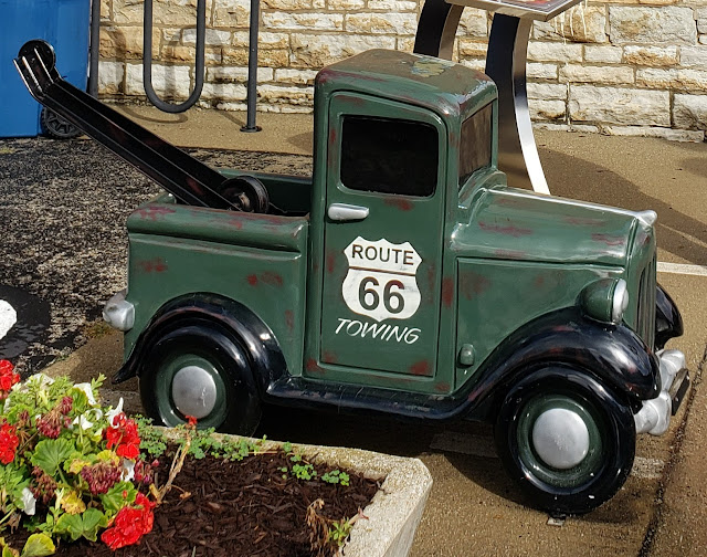
Along the streets near the courthouse are shops and cafes. Just west of the Courthouse is Pontiac-Oakland Auto Museum, which we didn’t have time to visit. Instead, we walked south to East Water Street, then east to South Riverview Drive. Along the way, we saw some of the adorable small vehicles scattered around downtown Pontiac sidewalks.

One of the little cars around downtown Pontiac

A little tow truck behind the Illinois Route 66 Museum

Two blocks south of East Water Street, just off South Riverview Drive, is one of Pontiac’s two swinging footbridges over the Vermilion River.  

1898 swinging footbridge in Pontiac, Illinois
Another view of Pontiac's 1898 swinging footbridge

We crossed the one first built in 1898; the other one was first built in 1926. The footbridges were built for workers living on the south side of Pontiac to commute to shoe factories on the north side. To be honest, they don’t really swing—they just bounce a bit as you walk on them.

Some of the streets in this section of Pontiac are paved in brick.

Some of the brick streets in Pontiac, Illinois

We drove out of Pontiac on Mill Street (IL 10) so we could see two more murals. Southbound travelers like us see a mural about the Vermillon River.

Vermilion River mural (from VisitPontiac.org)

The reverse side of the billboard welcomes northbound travelers to downtown Pontiac.

Downtown Pontiac mural (from VisitPontiac.org)

From Mill Street, we turned right (west) on West Reynolds Street to get back to the Route 66 bypass.

About 2 miles south of Pontiac, we saw one more gem: the former Illinois State Police Building, built in 1941 in art moderne style, with features like curves and glass bricks.

Former Illlinois State Police Building (from nps.gov)

It’s listed on the National Register of Historic Places but is now sadly abandoned.

You can see why we loved our visit to Pontiac! We were really glad we spent a couple of hours here. 

Our next stops were two more Illinois towns along Route 66: Lexington and Towanda.