Sunday, May 21, 2023

Ludlow, Newberry Springs, and Daggett, California

California’s Mojave Desert continues past the “alphabet towns” all the way to the Cajon Pass outside San Bernadino. The landscape continues to be beautiful but desolate, and the towns struggle in the harsh conditions.

When we visited in October 2022, Route 66 between Amboy and Ludlow was closed to all traffic because of bridge washouts. So from Amboy we took Kelbaker Road north to I-40, then took I-40 west to Ludlow. Ludlow feels like an oasis, even though it’s almost a ghost town. There is gas here, and we had lunch at the Ludlow Café. It was our first opportunity for a sit-down meal since Needles.

Ludlow Cafe

The Ludlow Café is a great example of mid-century Googie (space age) architecture. But the interior has more of an Old West vibe. I hope that someday the interior can get a mid-century modern renovation to complement the building's soaring design.

Interior of the Ludlow Cafe

After lunch we drove east on Route 66 (National Trails Highway or CA 66). In a few hundred feet we reached several abandoned buildings—the part of Ludlow that’s a ghost town. Unfortunately I wasn’t able to learn much about the stories of the buildings here. 

The first building we saw was an abandoned service station on the left (north) side of the road. It was once a Whiting Brothers service station, offering a lot of services including--if you look carefully at the column between the two service bays--arc welding!

Former Whiting Brother service station in Ludlow

Across the street is a motel cabin, the last one of a set of cabins that once ran along the road.

Former motel cabin in Ludlow

Past the Whiting Brothers service station is another old gas station with a dramatic "gull wing" canopy.

Across the road from this second gas station is the former Ludlow post office. 

Former Ludlow post office

The post office was also the motel office for the cabins that were once here. The empty sign looks like an old gas station sign. Maybe there was also once a gas station on this side of the street.

We went back to the Ludlow Café and turned right (north) to cross I-40. We then turned left (west) to continue on Route 66, which runs along the north side of I-40. 

Route 66 west of Ludlow

In about 6 miles, Route 66 turns left (south) to cross I-40, then turns right to continue west on the south side of I-40. In another 2 miles, Route 66 crosses the railroad.

Route 66 railroad crossing west of Ludlow

Route 66 runs along the south side of the railroad for a bit.

Route 66 between Ludlow and Newberry Springs (through a smudged windshield)

But soon the railroad turns away to head northwest and cross I-40. Route 66 now parallels I-40.

Route 66 east of Newberry Springs, with I-40 on the right

As we approached Newberry Springs, we started to see some lava fields.

Lava fields along Route 66 east of Newberry Springs

A few hundred feet past Oriente Drive on the right (north) side of Route 66 is the long-closed Whiting Brothers Dry Creek gas station, now behind a chain link fence. It still has its original gas pumps.

Former Whiting Brothers Dry Creek gas station in Newberry Springs

About a quarter mile past the Dry Creek gas station, also on the right (north) side of Route 66 is the Bagdad Café, closed at the time I write this (May 2023). Yes, the movie Bagdad Café was filmed here and, no, this is not the town Bagdad. Bagdad, California, is a now-vanished town between Amboy and Ludlow, along one of the stretches of Route 66 that were closed when we visited.

Bagdad Cafe in Newberry Springs

About 2 miles after the Bagdad Café, Route 66 crosses to the north side of I-40 and rejoins the railroad, running along the railroad's south side.

Route 66 west of Newberry Springs, with the railroad on the right

About 11 miles after crossing to the north side of I-40, we reached the town of Daggett. For two years—until 1928—Route 66 was on the north side of the railroad tracks, so we turned right (north) on Daggett-Yermo Road to cross the tracks to see it. We turned right (east) on Santa Fe Street, which was the original Route 66.

We immediately made a little detour, turning right (north) on 1st Street. On the left is the former Alf’s Blacksmith Shop.

Alf's Blacksmith Shop in Daggetts

Alf’s was built in 1894. It’s where 20-mule-team borax wagons were built, like the one we saw in Needles.

We continued east on Santa Fe Street another block. On the northeast corner of Santa Fe Street and Mill Street is Desert Market.

Former Ryerson's General Store in Daggett, now Desert Market

Desert Market was once Ryerson’s General Store. After a fire in 1908 destroyed Daggett’s commercial district, Ryerson’s was rebuilt with cement.

To the right of Desert Market are two vacant buildings.

Former People's General Store and Stone Hotel in Daggett

The wooden building on the left is People’s General Store, built in the early 1900s (presumably after the 1908 fire). The building on the right is the former Stone Hotel. It was built in the 1870s or 1880s as a 2-story hotel. After the 1908 fire, it was rebuilt as a 1-story hotel.

Half a block past the Stone Hotel, on the right, is Fout’s Garage.

Former Fout's Garage in Daggett

Fout’s was built in another town in the 1880s and moved here in 1896. It was first a livery stable, then a garage.

We returned to the post-1928 Route 66 (CA 66). On the southwest corner of Route 66 and A Street is a building called the Russian House, with a fascinating roof line.

Russian House in Daggett

To the right (west) of the Russian House is the former Mugwumps Service Station, built in the 1950s.


Former Mugwumps Service Station in Daggett

We continued west on Route 66 for two more miles. Route 66 runs through what is now the Barstow Marine Corps Logistics Base, which means that it’s closed to the public. So we had to detour around the base on I-40. We turned left (south) on Nebo Street and immediately got on I-40 west. In about 3 miles, we took the exit for East Main Street. We were back on Route 66, ready to continue our Route 66 adventure in Barstow.

Saturday, May 13, 2023

The Alphabet Towns of California's Mojave Desert

West of Needles, Route 66 crosses California's desolate Mojave Desert, following the railroad built through here in the 1800s. In the 1880s the Atlantic & Pacific Railroad created a series of small towns as water stops along its railroad. They’re called the “alphabet towns” because the railroad named them alphabetically from west to east: Amboy, Bristol, Cadiz, Danby, Essex, Fenner, Goffs, Homer, and Ibis. All the alphabet towns were eventually bypassed by newer alignments of Route 66 or by I-40. Today some are tiny towns, some are ghost towns, and some have vanished completely.

From Needles, we took I-40 about 7 miles to Exit 133 (US 95). Here two “alignments” of Route 66 split. The original 1926 alignment follows CA 66, which arcs to the northwest through the town of Goffs, then southwest to I-40. The 1931 alignment is gone, replaced by I-40.  We followed the original 1926 alignment by heading north on US 95.  In about 5 miles, we turned left (west) on CA 66. This intersection was once the alphabet town of Ibis.

We continued west on CA 66, running along the south side of the railroad. The alphabet town of Homer was once here, but all signs of it are gone.

Route 66 (CA 66) west of Goffs

In about 13 miles we reached the tiny town of Goffs. Just before Route 66 crosses the railroad tracks, we saw an abandoned general store on the north side of the road.

Former general store in Goffs

Right after crossing the railroad tracks, Route 66 turns left to continue west along the north side of the railroad tracks. In about 500 feet, we turned right (north) onto Lanfair Road. In a few hundred feet we reached Goffs Schoolhouse, built in 1914 and nicely restored.

1914 Goffs Schoolhouse

A sign near the schoolhouse explains that, during World War II, Goffs was the center of a desert army training camp, with as many as 10,000 troops stationed here.

Sign at Goffs Schoolhouse

The school is fenced and was closed when we visited. After we saw the sign below, we decided not to wander around!

Warning sign near Goffs Schoolhouse

A few hundred feet further north on Lanfair Road is a replica of the Goffs Santa Fe Railway Depot. It’s also fenced and was closed when we visited.

Replica of Goffs Depot

Goffs is called the Desert Tortoise Capital of the Road, but we didn’t see any. We visited in late October, and the tortoises hibernate underground from November through February.

West of Goffs, Route 66 continues along the north side of the railroad tracks.

Route 66 west of Goffs

Just before I-40, we saw the Desert Oasis gas station on the left. This is about all that's left of the alphabet town of Fenner. If you need gas, get it here—there’s no more gas for at least the next 55 miles.


Desert Oasis gas station in Fenner

About 3 miles south of I-40, Route 66 is closed because floods have washed out some of the bridges.

Route 66 closure at Fenner

So we took I-40 west about 30 miles to Kelbaker Road, then took Kelbaker Road about 11 miles south to rejoin CA 66. While we missed seeing what’s left of Essex and the Cadiz Summit, we were glad we drove Kelbaker Road, because the views are stunning.

Looking south on Kelbaker Road

When we reached CA 66 (also called the National Trails Highway), we  turned left (east). There’s a sign that the road is closed, but you can drive it about 5 miles or so before it really closes.

Route 66 road closure east of Kelbaker Road

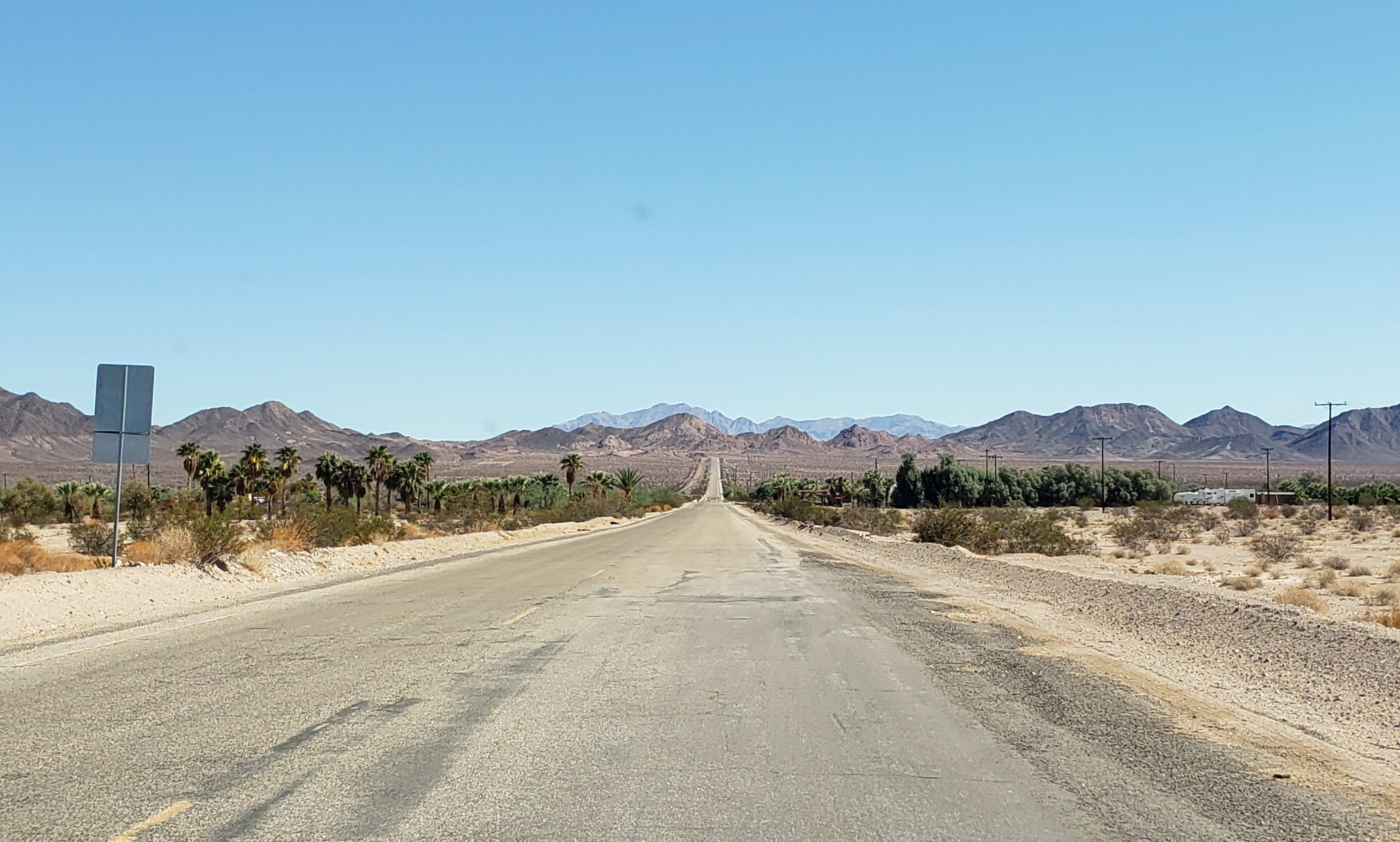
Once again the views were stunning. Far ahead, Route 66 bends to the left (northeast) and passes through Cadiz Summit.

Route 66 west of Chambless, looking west

Along the road is “rock graffiti”: hundreds of travelers have spelled out their names with rocks.

"Rock graffiti" along Route 66 west of Chambless

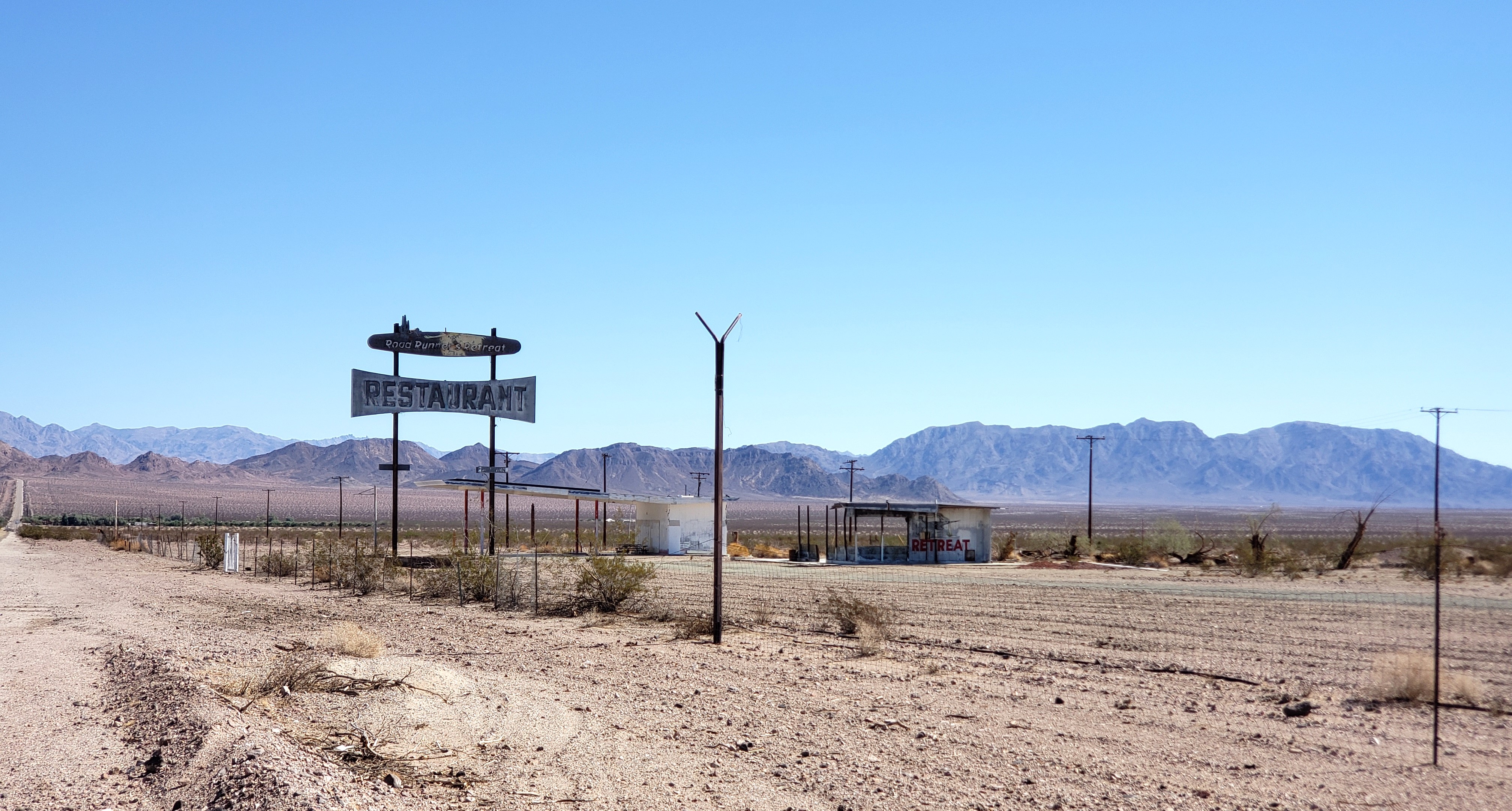
In about 4 miles, we reached the remains of the Road Runners Retreat.

Road Runners Retreat near Chambless

Road Runners Retreat was once a truck stop. The gas station is on the left and the restaurant on the right.

In another mile and a half, we reached the town of Chambless.

Chambless, California

You may recall that the “alphabet towns” included Cadiz, not Chambless. Between Essex and Amboy, the railroad and the original National Trails Highway runs a few miles south of Route 66. Cadiz was established along the railroad about 3 miles south of where Chambless is today. Route 66 was built north of the railroad and the original National Trails Highway, bypassing Cadiz. Chambless was established in the 1930s and named for the family who settled there.

What’s left of the Wayside Café is on the southwest corner of CA 66 and Cadiz Road.

Wayside Cafe in Chambless

There’s also a monument to Route 66 here with a plaque.

Route 66 plaque in Chambless

CA 66 is truly closed to all traffic past Cadiz Road, so we turned around and headed back west. We could see Amboy Crater, a volcanic cylinder cone, in the distance.

Route 66 looking west toward the (low black) Amboy Crater

About 4 miles west of Kelbaker Road we reached an iconic Route 66 stop: what’s left of the town of Amboy. Amboy was a true oasis for Route 66 travelers until I-40 opened. After I-40 opened, many of the structures were bulldozed to avoid paying property taxes on them. But there's still a post office here on the south side of the road.

Amboy Post Office with Amboy Crater on the right

The remains of Amboy School are here, too, on the north side of the road. 

Amboy School

But what makes Amboy iconic is Roy’s, a complex built to serve Route 66 travelers.

Roy's in Amboy

Today Roy’s is an icon of a lonely desert gas stop and has appeared in films, ads and commercials, video games, and more. (Wikipedia has a pretty extensive list.)

Roy Crowl opened Roy’s gas and service station in 1938. In 1945 he and his son-in-law added a café, which is now a gift shop.

Former cafe at Roy's, now a gift shop

Interior of the former cafe at Roy's, now a gift shop

In 1948 Roy and his son-in-law added cabins.

Cabins at Roy's

A true motel was built behind the cabins and, in 1959, Roy and his son-in-law added Roy’s iconic sign and motel office in space-age “Googie” style.

Roy's motel office, cabins and sign

While all the buildings have been spruced up on the outside, only the gift shop in the former café is open.

West of Amboy, Route 66 was again closed because of bridge washouts when we visited in October 2022. So, after this great stop, we drove back east toward Kelbaker Road, enjoying the magnificent views one last time.

Route 66 east of Amboy, looking east

We then drove back north on Kelbaker Road to I-40 and our next Route 66 stop: Ludlow, California.

Wednesday, April 19, 2023

Topock, Arizona, and Needles, California

The Oatman Highway (AZ 10) ends just after passing the town of Topock, Arizona. As the road approaches I-40, it curves right (west) to briefly parallel railroad tracks. It then makes a hairpin turn to cross under the railroad tracks, then go east between the railroad and I-40. Here, on the north side of the road next to the railroad tracks, is a water tower built in 1908.

Topock Water Tower

When AZ 10 crosses I-40, the long unbroken stretch of original Route 66, which began east of Seligman, Arizona, ends. You must get on I-40 to cross the Colorado River and enter California. But, if you can safely pause on the overpass over I-40, you can see two sights. To the east are some mountains called The Needles. They appeared in the movies The Grapes of Wrath and Easy Rider.

The Needles, south of Topock

And to the west is a beautiful bridge.

Old Trails Bridge near Topock

This bridge was built in 1916, a decade before the National Old Trails Highway became Route 66. I’ve seen it called the Old Trails Bridge, Trail Arch Bridge, and Old Trails Arch Bridge. Today it only carries a pipeline; it is closed to traffic and pedestrians.

Instead of getting on I-40 into California, we took a detour off Route 66. We went east on I-40 to Exit 9 (AZ 95), then took AZ 95 south to Lake Havasu City, Arizona. Lake Havasu is a real contrast from Route 66, because it was created in 1963, decades after Route 66 was established. It’s most famous as the home of London Bridge, which was installed here in 1971.

London Bridge in Lake Havasu City

London Bridge at night
We spent the night at the Holiday Inn Express, which has great views of London Bridge, and ate dinner at The Chair next to the bridge. It was a very pleasant break—to us, it was worth the detour. 

The next morning we backtracked to I-40 west, now crossing the Colorado River and entering California. (Tip: Get gas before entering California—it’s much more expensive there.)

We wanted to take the original 1930s Route 66 alignment to Needles, so about a mile after crossing into California, we took the exit for Park Moabi Road, turning right (north) onto Park Moabi Road. In about a mile, we turned left (west) on National Trails Highway—the original Route 66. We soon encountered this:

National Trails Highway west of Park Moabi Road

At the time, we thought National Trails Highway was blocked off. Afterwards, I studied my maps again and I now think National Trails Highway veers left, crossing under the railroad tracks. No matter—it would have been far too rough for us to feel comfortable driving. So we backtracked to I-40 and continued west on I-40 to the exit for Five Mile Road. We turned left (west) on Five Mile Road. Here the National Trails Highway that we wanted to drive merges into Five Mile Road, so we were back on the 1930s Route 66 alignment. In about a mile, Five Mile Road merges into US 95—still the 1930s Route 66 alignment. 

US 95 (1930s Route 66 alignment) south of Needles

We continued on US 95 north about five miles into Needles, California. Here US 95 (Route 66) becomes Broadway Street.

Just off Route 66, at 91 Desnok Street, is the adorable 66 Motel, built in 1945-1947.

66 Motel in Needles

The 66 Motel has a great old sign on Route 66, pointing travelers to the motel.

66 Motel sign

About 3 blocks north of the 66 Motel on Route 66, just past Palm Way, is the former Old Trails Inn. It opened in the 1930s as the Palms Motel.

Former Palms Motel in Needles

Across Route 66 from the Old Trails Inn, a borax wagon welcomes visitors to Needles.

Borax wagon in Needles

The wagon is a tribute to the wagons that once hauled borax out of nearby mines. (We’re old enough to remember TV commercials for “20 Mule Team Borax.”) This wagon was once in front of the long-gone El Rancho Motel a bit north of here.

Four blocks north of the borax wagon is a beautiful 1930s art deco building at 725 West Broadway Street.

Former Claypool & Company Hardware

The building once housed Claypool & Company Hardware. Today it houses Palo Verde Community College.

A block past the Claypool building, we turned right on F Street, then left on Quinn Court. On the right (north) side of Quinn Court is the beautiful El Garces Hotel.

El Garces Hotel

The El Garces Hotel was built in 1908 to replace a train depot that burned. It was designed to look like a Greek temple. It was one of the Harvey House chain built primarily to serve railroad passengers. (See my post on Winslow for more information on the Harvey Houses.) It is open for tours by appointment only; inquire at the Needles Regional Museum across the street.

On the north corner of the park in front of the hotel is a great sign honoring both Route 66 and Needles' railroad heritage.

Route 66 sign in front of El Garces Hotel

And across Quinn Court from the hotel is a Route 66 gem: the Needles Regional Museum in a former J.C. Penney’s department store.

Needles Regional Museum

The building has a great mural on its right (north) side.

Needles Regional Museum mural

The museum itself is a wonderful Route 66 stop. At the entrance is a statue of Spike, Snoopy’s brother.

Spike (and a lot of other cool stuff) at the Needles Regional Museum

Charles Schulz, who created the Peanuts comic strip, lived in Needles as a child for a few years. In the strip, Spike lived in the desert but periodically came into Needles.

 The museum staff were wonderful—in a few minutes we learned a great deal about the Needles region, including the Harvey House across the street and the Old Trails Bridge near Topock. We wish we could have spent even more time here!

 We returned to Broadway Street via G Street. On the northeast corner of Broadway and G Streets is another cool Route 66 sign.

Route 66 sign on the corner of Broadway & G Streets

We turned right (north) on Broadway Street and drove about three-quarters of a mile before turning left (west) to stay on Broadway Street and Route 66. Here Broadway Street is also called Needles Highway. In about half a mile Needles Highway bends a bit to the right. Here a restored Texaco station is at 2211 Needles Highway.

Texaco station in Needles, with Route 66's ever-present trains running behind it

Across Needles Highway from the Texaco Station, at 2302 Needles Highway, a Chinese restaurant is in a former Denny’s, complete with classic boomerang roof.

Former Denny's in Needles

About a quarter mile past the former Denny’s is a Route 66 institution: the Wagon Wheel Restaurant at 2420 Needles Highway.

Wagon Wheel Restaurant in Needles

There are very few services between Needles and Ludlow, California—a good 2½ hour drive if you’re taking the original Route 66. So consider getting gas and something to eat here and make sure you have plenty of water and snacks. If you’re using a GPS, set it before you leave, as cell phone service will be spotty.

After the Wagon Wheel, the Needles Highway crosses I-40. In about a mile, the road forks, with National Old Trails Road on the left and Needles Highway on the right. We took the National Trails Road on the left. When it ended in about a mile, we turned left (west) on West Park Road, then took I-40 north toward CA 66, one of the most desolate, haunting stretches of Route 66, crossing the Mojave Desert.