Our last stops on Route 66 in Oklahoma were the towns of Elk City, Erick, and Texola. As we drove west, the towns became smaller and more remote.
We left Clinton, Oklahoma, on the 1931 “alignment” of Route 66 (West Commerce Street), which became the South Frontage Road of I-40.
 |
| Route 66 west of Clinton, Iowa |
In about 6 miles, I-40 and the frontage road bend slightly left (southwest). Here we turned right (north) on North 2170 Road, crossed I-40, then turned left (west) on the North Frontage Road of I-40. This kept us on the 1931 alignment of Route 66.
After about 6 miles, just past the Elk City KOA campground, the North Frontage Road ends at NS 211. We turned left (south) on NS 211, crossed I-40, and turned right (west) on the South Frontage Road. This kept us on the 1931 alignment of Route 66 into Canute, Oklahoma.
At 605 Old US Highway 66 in Canute is the much-photographed neon sign of the former Cotton Boll Motel.
 |
| Cotton Boll Motel sign (from waymarking.com) |
The Cotton Boll Motel was built in 1960.
Outside of Canute, Route 66 again becomes the South Frontage Road of I-40. In about 2 miles, we turned right (north) onto North 2050 Road and crossed I-40. We then turned left (west) on the North Frontage Road (East State Highway 66). When this road ended just before Elk City, Oklahoma, we turned left (south) on OK 34, then immediately right (west) on Business I-40, also known as East Highway 66 (Route 66). We followed Route 66 into Elk City.
At the northeast corner of Route 66 and Main Street is the former Casa Grande Hotel.
 |
| Former Casa Grande Hotel in Elk City, Oklahoma |
Built in 1928, the Casa Grande was the only high-rise hotel between Oklahoma City and Amarillo. Its style is called Spanish Eclectic. It was the location of the 1931 convention of the US 66 Association and is on the National Register of Historic Places. Behind it is the world’s tallest non-operating drilling rig.
We walked up and down Main Street, which is a classic example of a small-town America downtown.
 |
| Downtown Elk City, Oklahoma |
I was especially struck by the First National Bank building at 102 South Main Street.
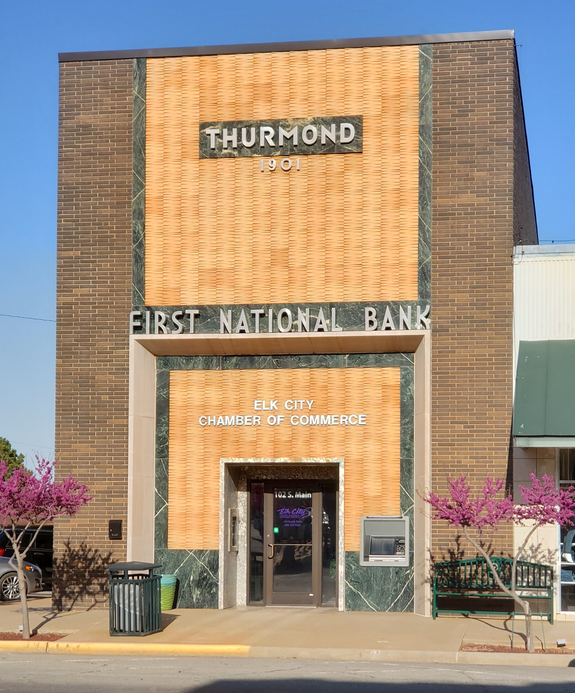 |
| Former First National Bank in Elk City, Oklahoma |
We
spent the night in Elk City at the Bluebird Inn at 118 West Broadway Avenue.
It’s a three-room inn recently—and beautifully—converted from a store. In the
lobby was a book on the First National Bank! I learned that the bank building was built in
1903 and updated several times.
 |
| Old photo of Elk City's First National Bank building |
This is what it looked like in 1951.
 |
| 1951 photo of Elk City's First National Bank building |
Elk City has a National Route 66 and Transportation Museum, but it was closed when we visited (we arrived in Elk City in the evening and left early the following morning).
West of Elk City, Route 66 again becomes the North Frontage Road of I-40. After about 7 miles, it ends at North 1910 Road. Here we turned left (south), crossed I-40, and turned right (west) to continue on South Frontage Road. We soon crossed Timber Creek Bridge, built in 1928.
 |
| Timber Creek Bridge between Elk City and Sayre, Oklahoma (from wayfinding.com) |
In about a mile, South Frontage Road ends at the TA Travel Center. Here we turned right (north) on North 1900 Road, crossed I-40, then turned left (west) on the North Frontage Road to continue on Route 66. Just before Sayre, Route 66 turns right (west) onto Business I-40 through Sayre, Oklahoma. In Sayre, on the southwest corner of Route 66 and Main Street we saw a beautiful building: the former First National Bank.
 |
| Former First National Bank in Sayre, Oklahoma |
South of Sayre, we wanted to take an older alignment of Route 66. So, just before Sayre City Park, we turned right (west) on West Kennemer Street. When it ended in about half a mile, we turned left (south) on a road called BK 21. This was the original 1926 “alignment” of Route 66. In about a half a mile, Southwest Highway 66 forks to the right (southwest) and joins Business I-40 (North Frontage Road). This road was westbound Route 66 from 1958 to 1970.
In about 12 miles, Business I-40 (Route 66) reached Erick, Oklahoma. Erick is the home of Roger Miller and Sheb Wooley and, yes, there is a Roger Miller Avenue and a Sheb Wooley Street. There is a great mural of Roger Miller on the southeast corner of Route 66 and Sheb Wooley Street.
 |
| Roger Miller mural in Erick, Oklahoma |
On the southwest corner of the same intersection is another beautiful old bank building.
 |
| Former First National Bank in Erick, Oklahoma (from Google Maps) |
Notice how similar it is to the bank building in Sayre!
About 4 or 5 miles past Erick on Business I-40 is the last Oklahoma town on Route 66: Texola. I’d read that Texola is almost a ghost town, and indeed a lot of the buildings are abandoned and falling apart. We turned right (north) on Main Avenue and drove one block to see Texola’s 1910 Territorial Jail.
 |
| Texola Territorial Jail |
The jail is marked on Google Maps as One Room Jail. We were able to peek through the front gate to the interior.
 |
| Texola Territorial Jail interior |
Just outside Texola, Business I-40 (Route 66) crosses into Texas. We were on our way to a great Route 66 stop: Shamrock, Texas.


No comments:
Post a Comment